
Hiking Japan: From Okinawa to Hokkaido
Letters from Japan, February 2026: My favourite hikes in Japan, from Okinawa to Hokkaido, and a snowstorm in Tokyo.

Good afternoon,
According to Japan’s traditional micro-season calendar, which divides the year into 24 solar terms and then into 72 micro-seasons, each marked by adorably descriptive natural events such as “fish emerging from the ice,” spring has already begun.
Yet last Sunday, just as “the east wind was melting the ice” and “bush warblers were about to start singing in the mountains,” with plum blossoms already out across the city, Tokyo seemed to defy these seasonal signs, crowning this much colder-than-usual winter with a snowstorm.
Snow is rare in Tokyo and, fearing it might disappear at any moment, I went out at 3 a.m., moving from one neighbourhood to another, struggling to decide which ones to cover, aware that the show could end at any second.
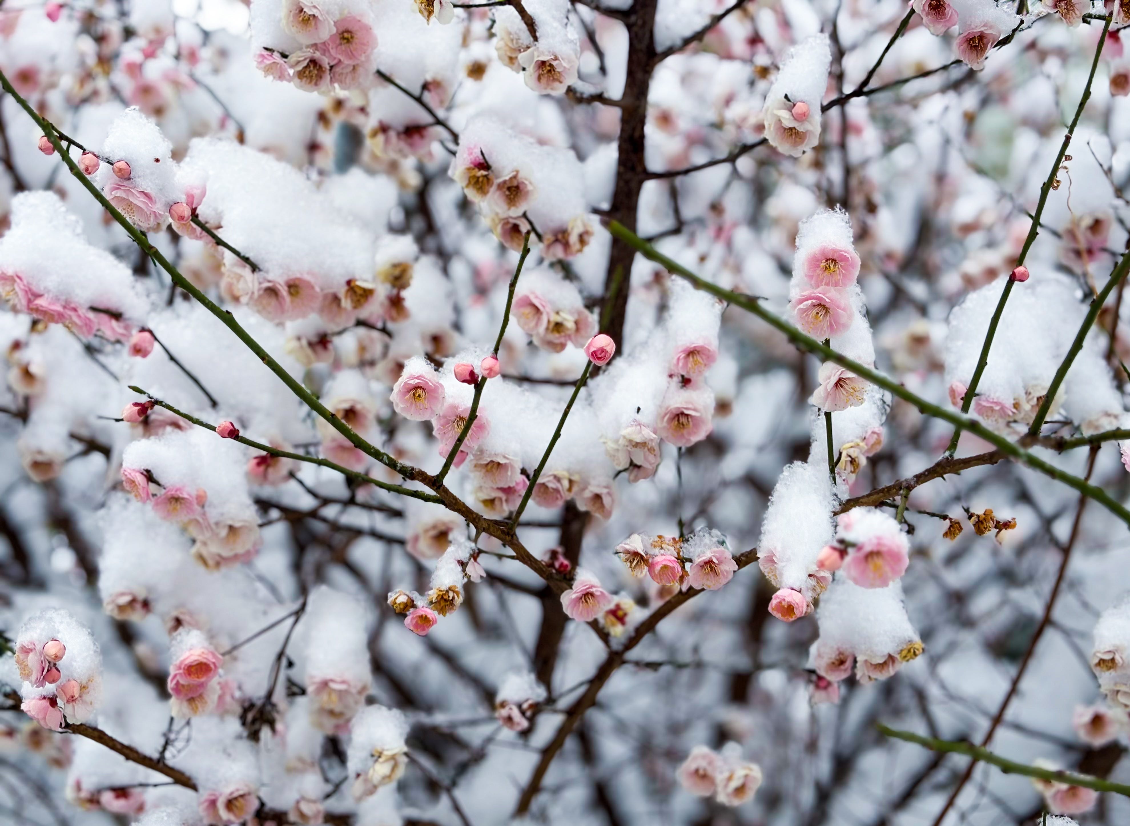
Apart from the joy of experiencing the city at such a slow pace, this was also my first time seeing plum blossoms in the snow. I was glad for the scenery, though worried the petals might not survive the weight (they did). It was certainly a beautiful day, one that gave me new reasons to appreciate this wonderful city.
Snow, after all, always seems to bring out the soft side of big cities, even when it may not truly exist. My hometown, Istanbul, adopts a timid aura the moment the first flakes begin to fall, becoming unusually approachable. For a while, you forget the intense chaos and demands it throws at you on any other day. It lets you engage with it differently, even feel a little in charge, setting aside its otherwise commanding presence, the one that otherwise dominates your days and, if you let it, would happily take over your entire life.
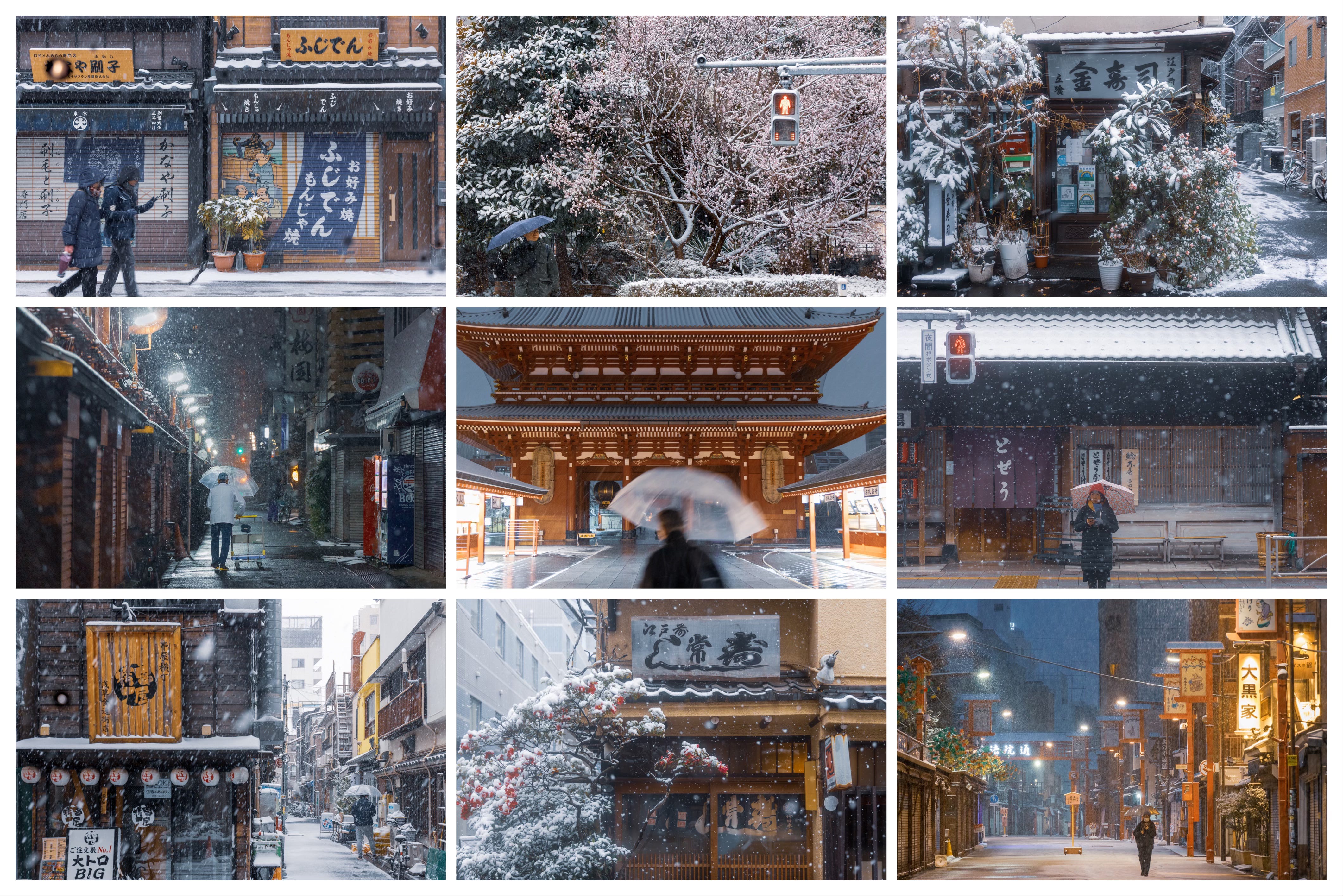
In Tokyo’s case, though, snow works a little differently. It strips the city of its excuses for hiding its true self. It puts everything into slow motion, making it easier to see it for what it really is, beneath the fast pace and high-tech image amplified by that big façade: the world’s largest small town disguised as a metropolis.
It is like a little boy wearing his father’s jacket - a city made of thousands of tiny villages that together feel much larger, and a little scarier, than they are individually. But the experience of living in this surprisingly gentle city is better reflected in one of those tiny villages than in its grander, slightly intimidating outer shell.
So, on that fine Sunday, I thought how lucky passersby were to experience Tokyo at its softest, which is, in fact, its truest self.
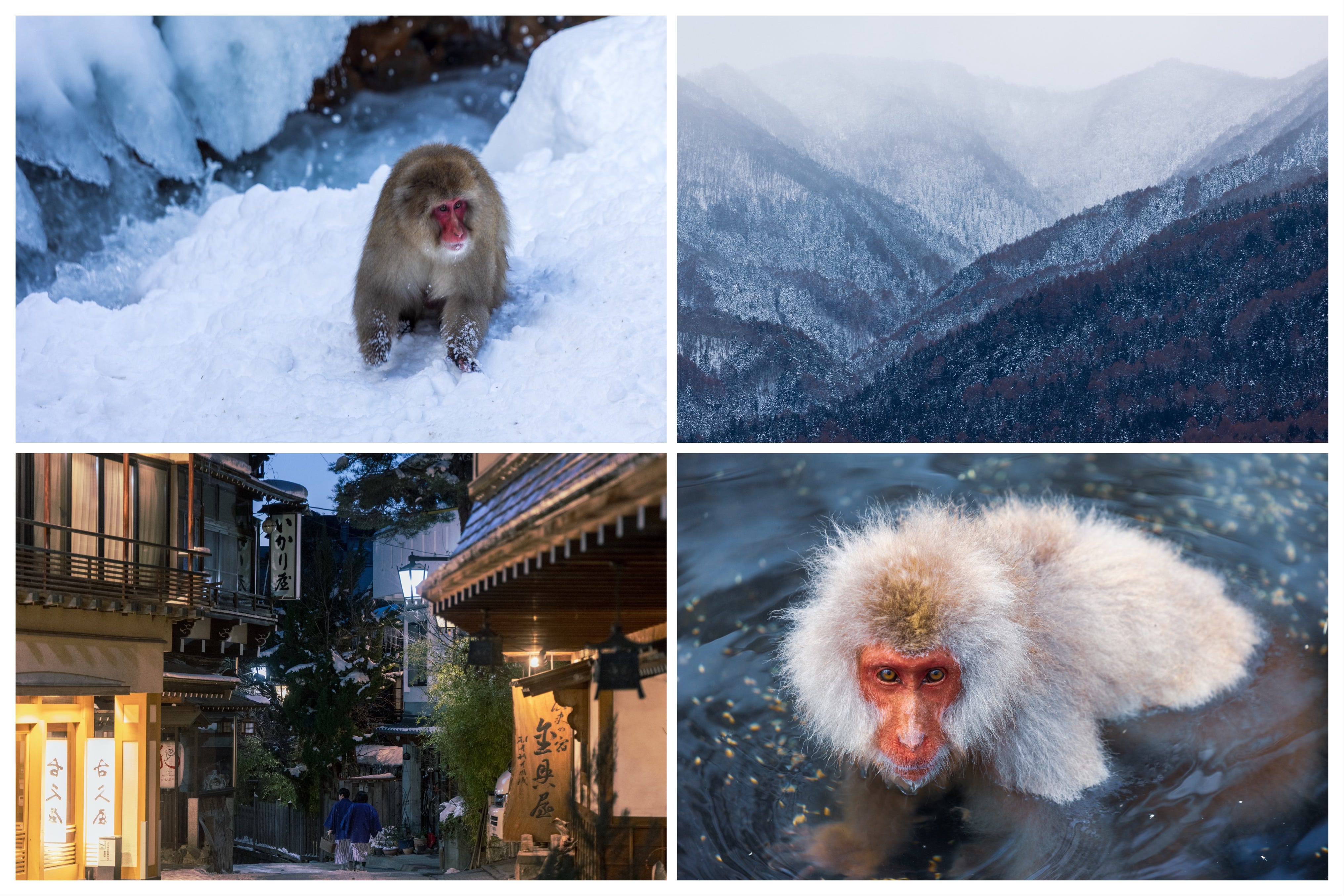
Unless Tokyo has another surprise in store for us, this was likely my last snow encounter of the year, and therefore the last snowy edition of Letters from Japan for a while, after January’s Snow Country and, more recently, early February’s Shibu Onsen and the Snow Monkeys.
But now, if we trust Japan’s micro-season calendar, which says that “the grass will soon sprout, and trees bud”, it may be a good time to start imagining warmer days and to delve a little deeper into one of the main underlying themes of this newsletter: hiking in Japan.
So, in this month’s letter, I come to you with the geographical breakdown of some of my favorite trails in the country, covering peak hunts, island traverses, mangrove kayaking routes, pilgrimage paths, and a few entirely DIY walks.
Naturally, the list includes only the trails I have personally experienced1 and is therefore far from comprehensive. You will notice that the country’s hiking mecca, the Japanese Alps, known for its hair-raisingly exposed trails, is represented with only a few routes. For those looking for a much more exhaustive list and technical guidance, David Lowe’s thoughtful blog, Ridgelineimages, is a wonderful resource that will have you safely covered.
The format of this letter will be similar to September’s Reading Japan: From Hokkaido to Okinawa, jumping between regions and offering brief mentions of the trails I love in each one, but this time in reverse order.
We will start in Okinawa, on one of its southernmost islands, Iriomote; move on to another island destination, Yakushima; cross the mainland slowly with various stops along the way, occasionally leaving it again for smaller islands; and finish in Hokkaido, first exploring the mainland and then crossing to one of its farthest islands.
Okinawa is not one of the first destinations that come to mind when one thinks about hiking in Japan. The islands are better known for their swimming waters, some of the best in the world, and their locals, who long ago unlocked the secret to the “eternal youth”, which, in their own words, has more to do with the diet than hiking.
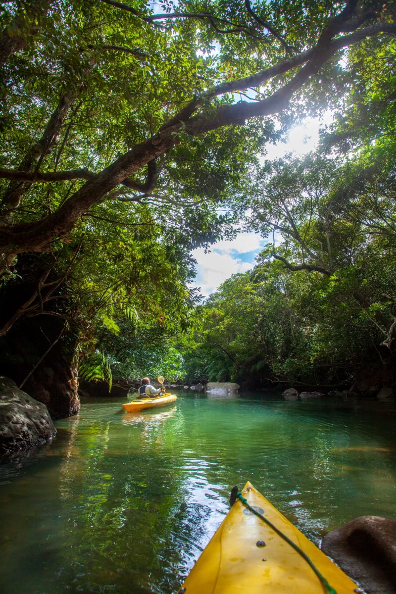
Yet the archipelago, consisting of 160 islands, is also blessed with subtropical rainforests and mangrove fields that you can kayak through, offering a jungle-like hiking experience - complete with hidden waterfalls - that cannot be found on the mainland.
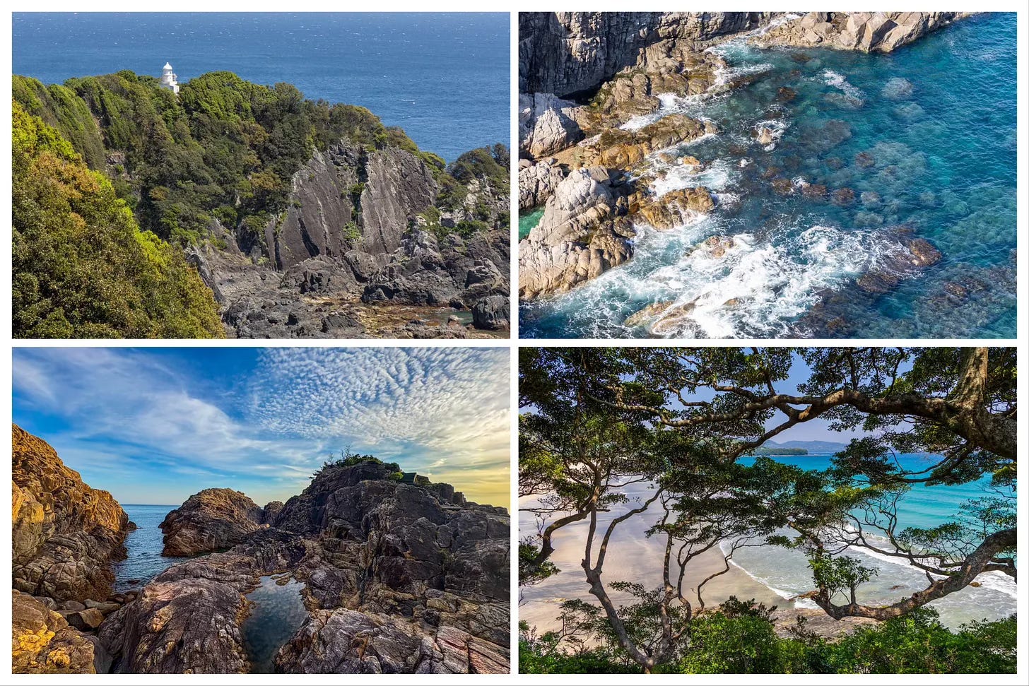
I don’t think I fully appreciated the climatic diversity this long, skinny country harbors until I visited Iriomote Island, one of the southernmost islands in the Okinawa chain, in January. While Hokkaido, with its subarctic climate, was in the harshest phase of its endless winter, we were kayaking and hiking through the jungles of Iriomote, as if it were a summer day.
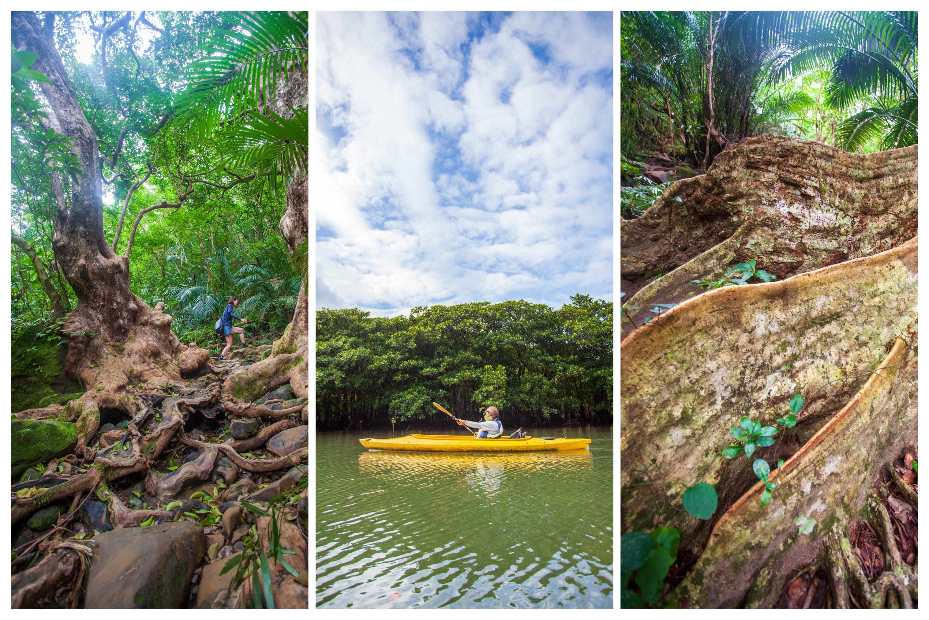
Iriomote, the second-largest of the Okinawa islands, is almost entirely covered by forest and mangroves and is home to the endemic Iriomote cat, a nocturnal species found nowhere else in the world. With only around ten percent of its land devoted to urban development, it is no surprise that the island, albeit a little late, was added to the UNESCO World Heritage list in 2021.
The Pinaisara Falls and Sangara Falls trails, both beginning with a kayak journey through mangrove forests and ending at a waterfall after a dense climb through the jungle, were two routes I got to experience - both making me feel a little ashamed that I had, until then, only visited Okinawa for its beaches and its otherworldly swimming waters.
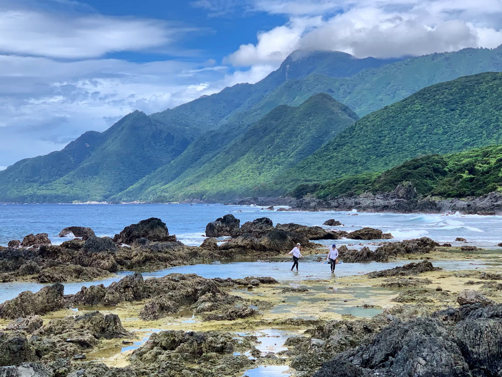
Moving north from Okinawa, but not quite yet on the mainland, we arrive at another island whose hiking-related reputation extends far beyond Japan. Some call it the place where it rains thirty-five days a month. “The Alps of the Ocean” is another nickname favored by travel brochures.
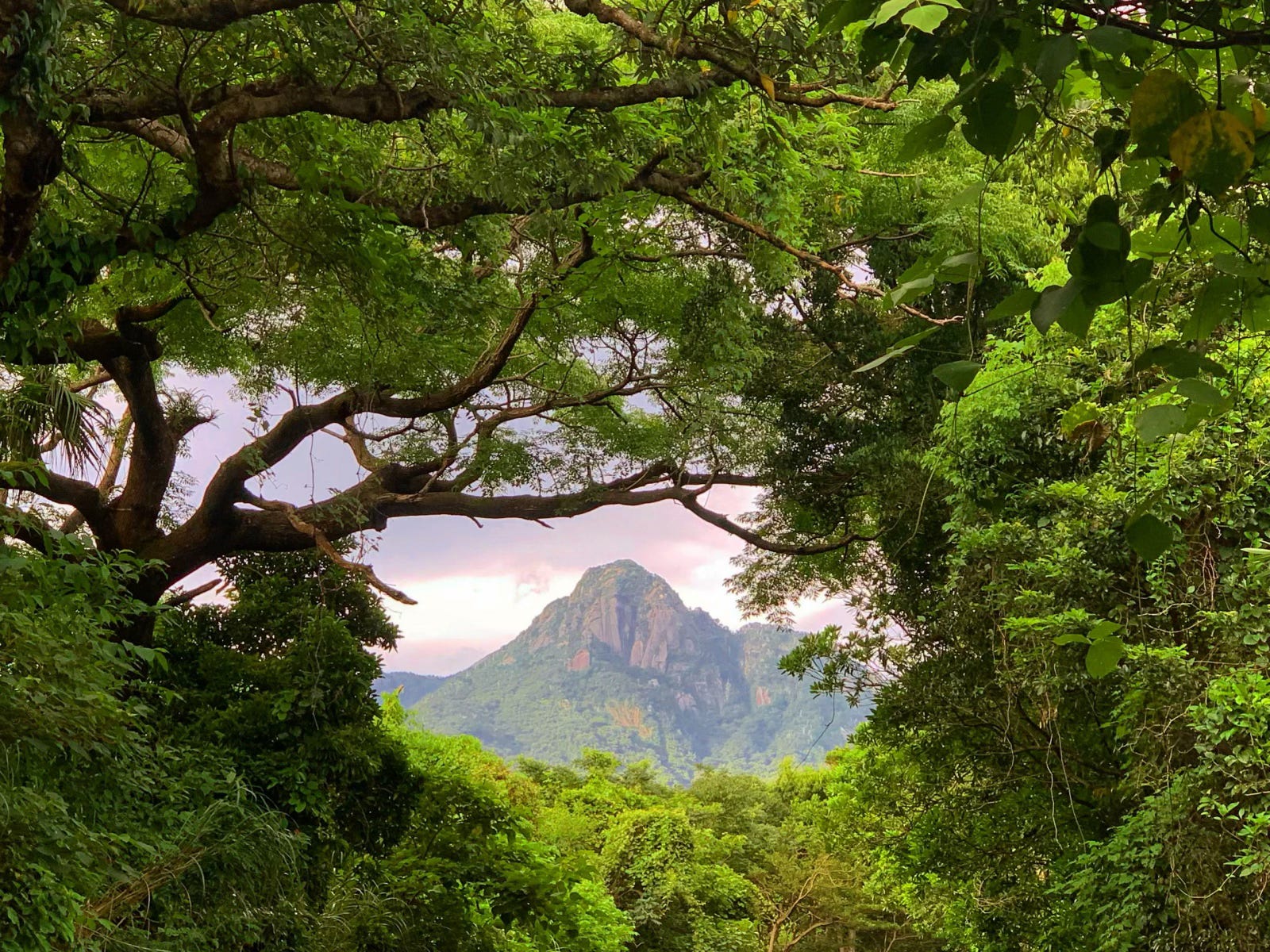
These cheesy descriptions point to two essential truths about Yakushima, which, in fact, is one of the least cheesy places I have been to in Japan. It is rainy, the wettest place in the country, and home to an unusually diverse climate, where, on the same day, you can move from a subtropical coast to near-subarctic peaks, including Kyushu’s highest mountain, Mount Miyanoura.
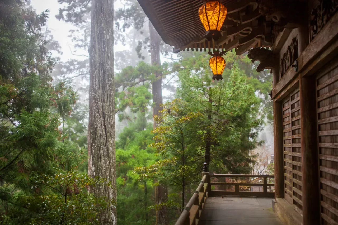
The heart-shaped island, also on the UNESCO World Heritage list, owes much of its global fame to Hayao Miyazaki, who reportedly drew inspiration from its moss forests for Princess Mononoke. While Shiratani Unsuikyo, home to Miyazaki’s moss forest, is a beautiful trail, the island traverse hike, ideally done over two days, offers a more memorable chance to experience Yakushima’s unique ecosystem and climate.
The traverse, despite its intimidating name, is not especially challenging, particularly when paired with a stay at one of the mountain huts along the way. While it is served by numerous trailheads, the more common route, which I also followed, starts at Yodogawa, crosses the river in the early morning light (the eternal kind on a sunny day), climbs to Mount Miyanoura by around noon, and then descends through a dark, deliciously spooky forest to one of the huts.
The next day takes you to Jomon Sugi, the oldest tree in Japan, with the option to finish either at Arakawa by following old train tracks for the final two hours, or via a detour to Shiratani Unsuikyo for a longer but visually more rewarding ending.
Now taking a little break from the small islands off the mainland, we move to a much larger main one: Kyushu, also known as the land of fire.
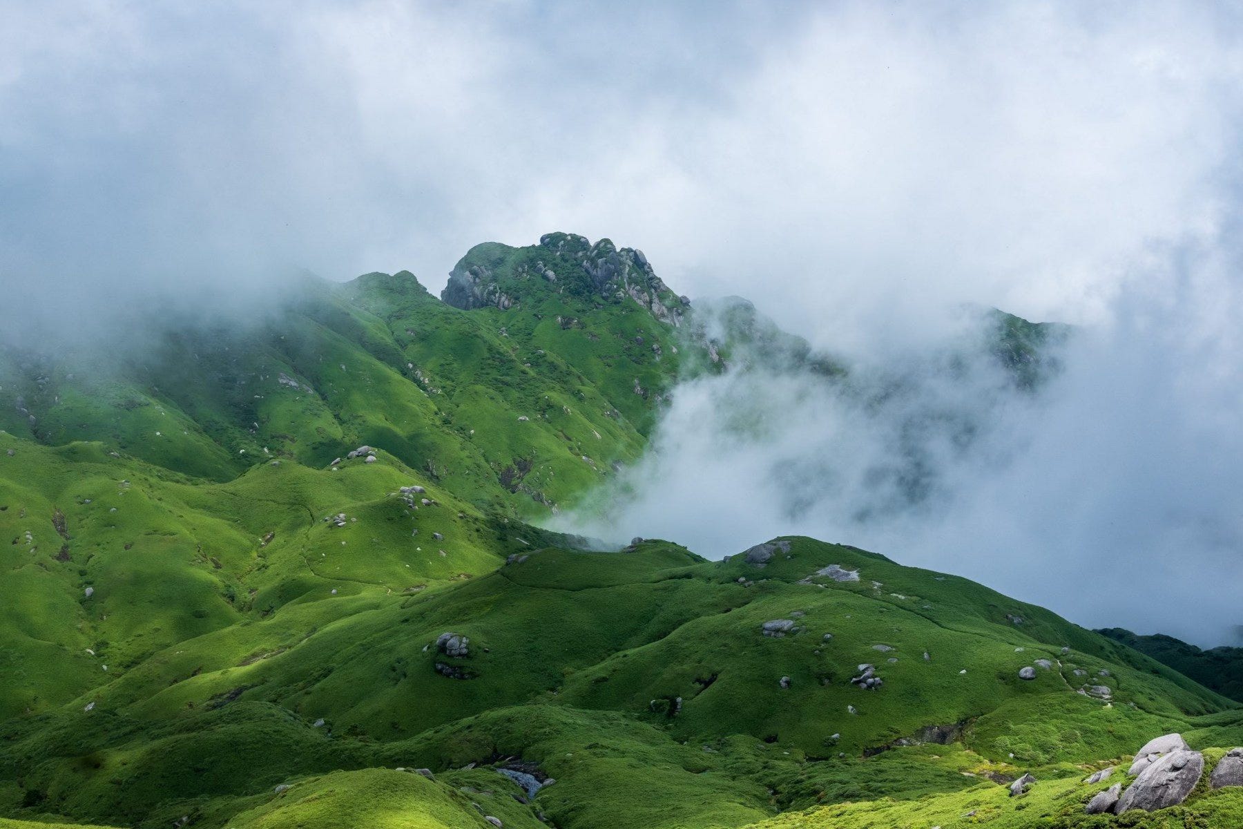
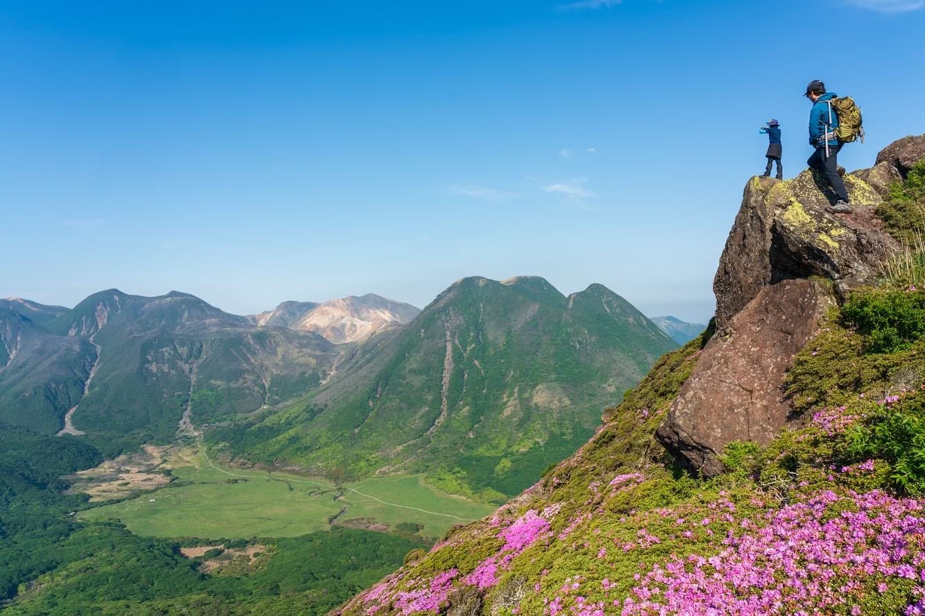
Among the various trails that I got to experience on this highly volcanic island, the one that I repeatedly return to is the Kuju Mountains.
Kuju is the neighbour of the better-known Mount Aso, with which it shares the national park’s name: Aso-Kuju National Park.
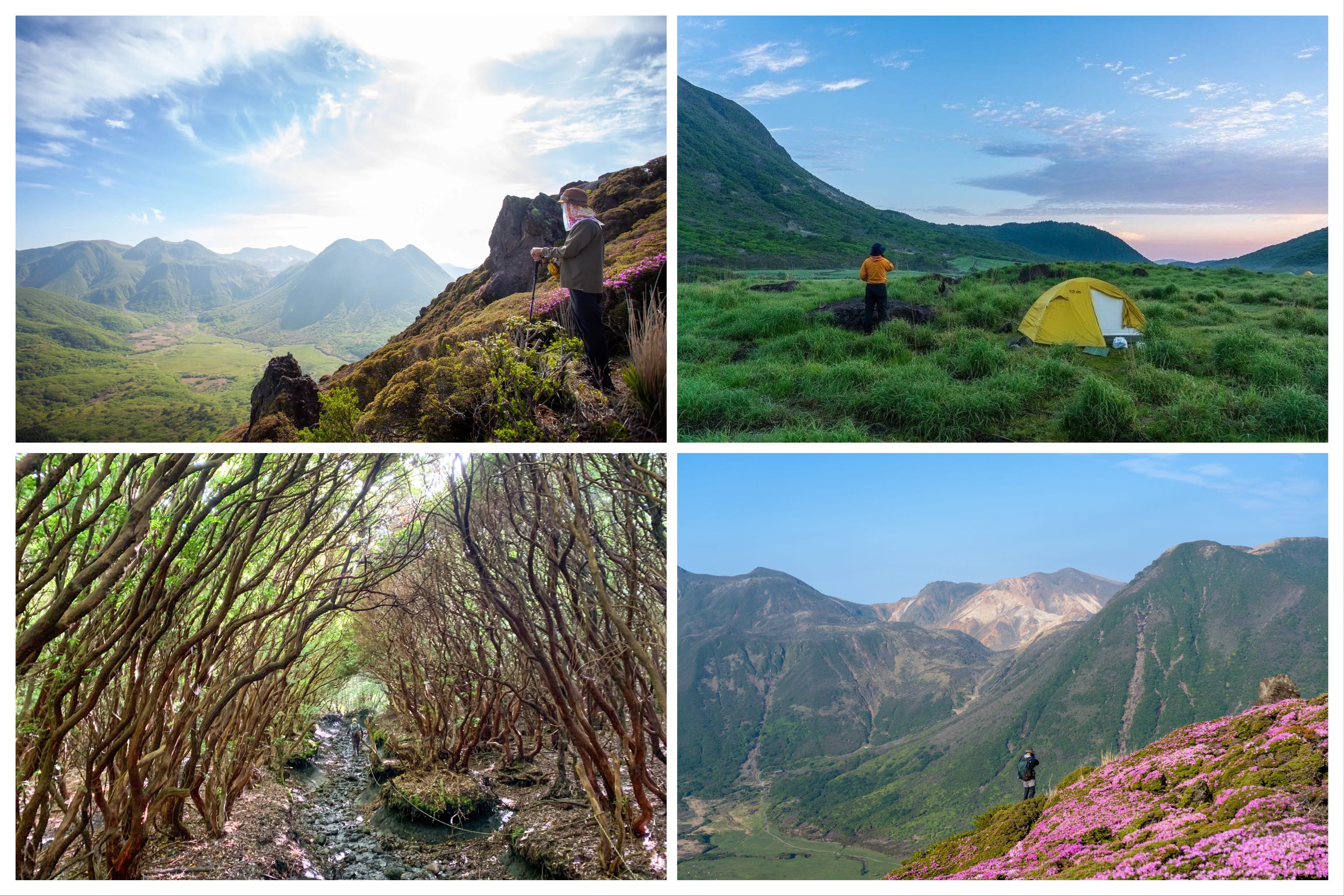
While Aso, one of the world’s largest and most active volcanoes, with a massive caldera, is geologically the more interesting of the two, the Kuju side of the park always feels scenically more enticing to me, especially in late May, when its various peaks bloom with azaleas. It is also one of the rare mountain regions in a country famous for brutally steep trails, where the effort you put in feels almost too small for the scenery you are rewarded with.
The Kuju range is home to various trails. One can easily spend a week up there, exploring a new route each day. So, if you have time, staying in the mountains for a few nights is a great option, either at the ever-welcoming Hokkein Sanso or at one of the campgrounds. But if time is tight, the day hikes are also worth the trip.
Just north of Kyushu lies Japan’s most rural main island, Shikoku. Best known for the Shikoku 88-Temple Pilgrimage Route, the island is, in my view, also one of the best places for DIY walks.
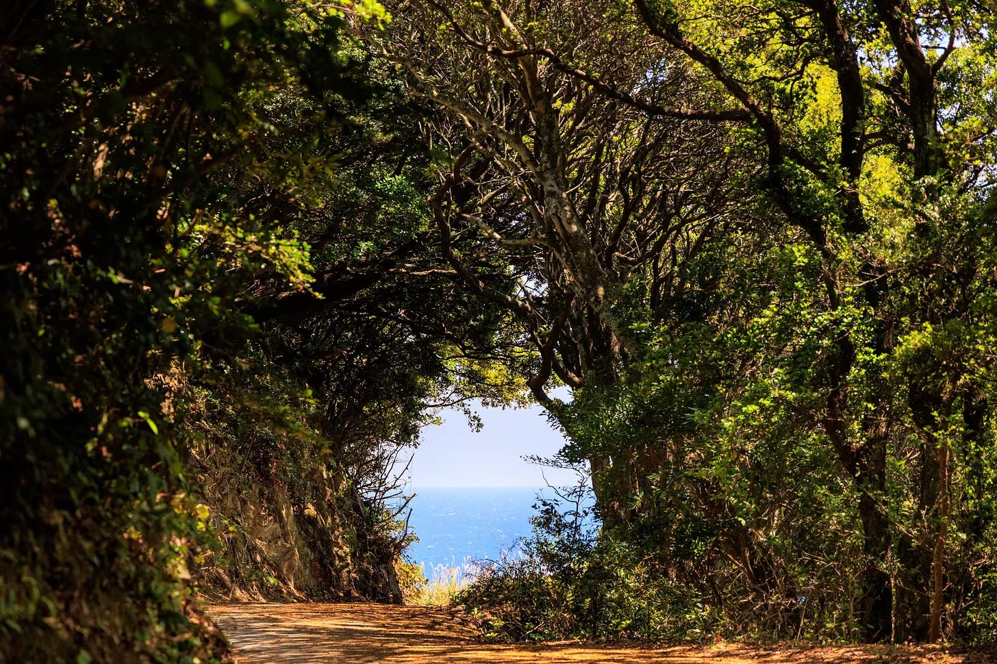
With its 1,200-kilometer-long pilgrimage route, the 1,500-kilometer-long Nature Trail, and scenic coastal routes connecting small fishing towns, Shikoku, which is fortunately also a little short on bears, presents many options to simply get out there and walk.
And last May, I did exactly that. I flew to Kochi, took the local train south, then a bus, and simply started walking, following the coastal route down to Cape Ashizuri. There was not much route planning involved, beyond following the coastline and giving my walk the made-up title of “Southern Shikoku Coastal Walk.”
The route, covering half the coast of Kochi Prefecture over four days, took me past surfing beaches, gorgeous lighthouses, small fishing villages, seaside shrines, and the iconic Cape Ashizuri, among many other sights, including plant-covered abandoned houses, a signature scene on the island.
It is a walk I would happily do again in a heartbeat, if I find the time, as it offered such an unfiltered glimpse into the deeply rural side of Japan.
The 88-Temple Pilgrimage Route, spanning 1,200 kilometers and typically completed in six to eight weeks, also offers ample opportunities to observe the countryside, alongside its main feature: temple stays. I have hiked only certain sections of this long trail, as you might guess, choosing the most scenic ones. But for a more complete account, David Gilbert’s 52-day journey on the route remains one of the best blog accounts I have read about the full experience.
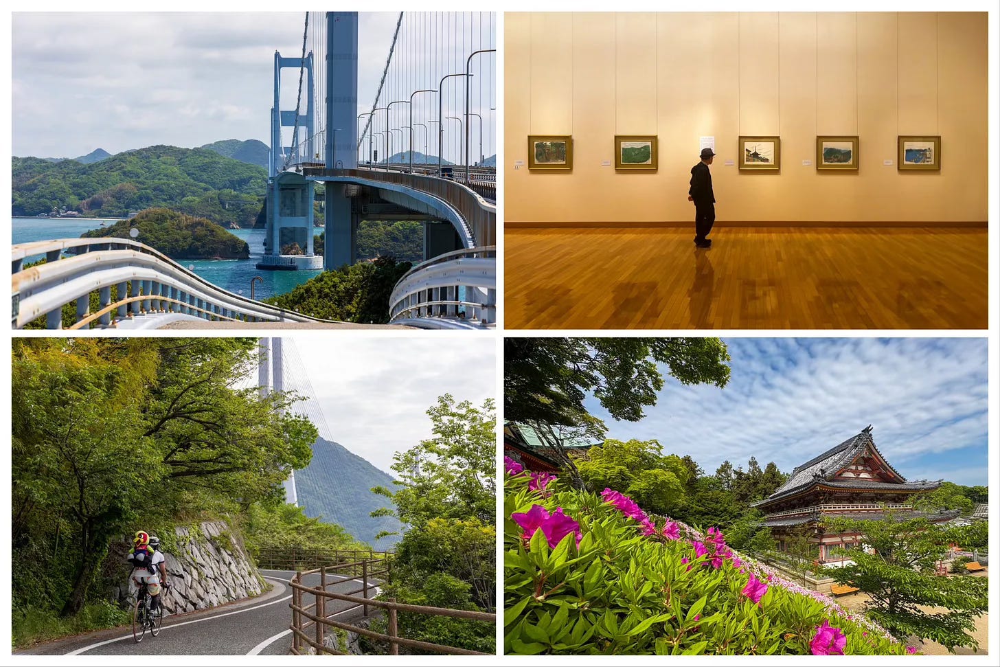
One of the most enjoyable ways to leave Shikoku behind and cross over to Honshu is to cycle across the seven bridges that span the Seto Inland Sea. The route can be done in a single day, but it works better as a more leisurely two-day journey.
Shimanami Kaido may not be an exceptionally scenic route, but it is a wonderfully enjoyable way to spend a few days getting to know the small islands of the inland sea, which often feel even more isolated than those farther off the mainland, maybe because they have the luxury to remain underdeveloped, being so close to the mainland.
Now on Honshu, we take a sharp detour to the east and reach the Kansai region, blessed with, and for some cursed, some of the most visited destinations in Japan.
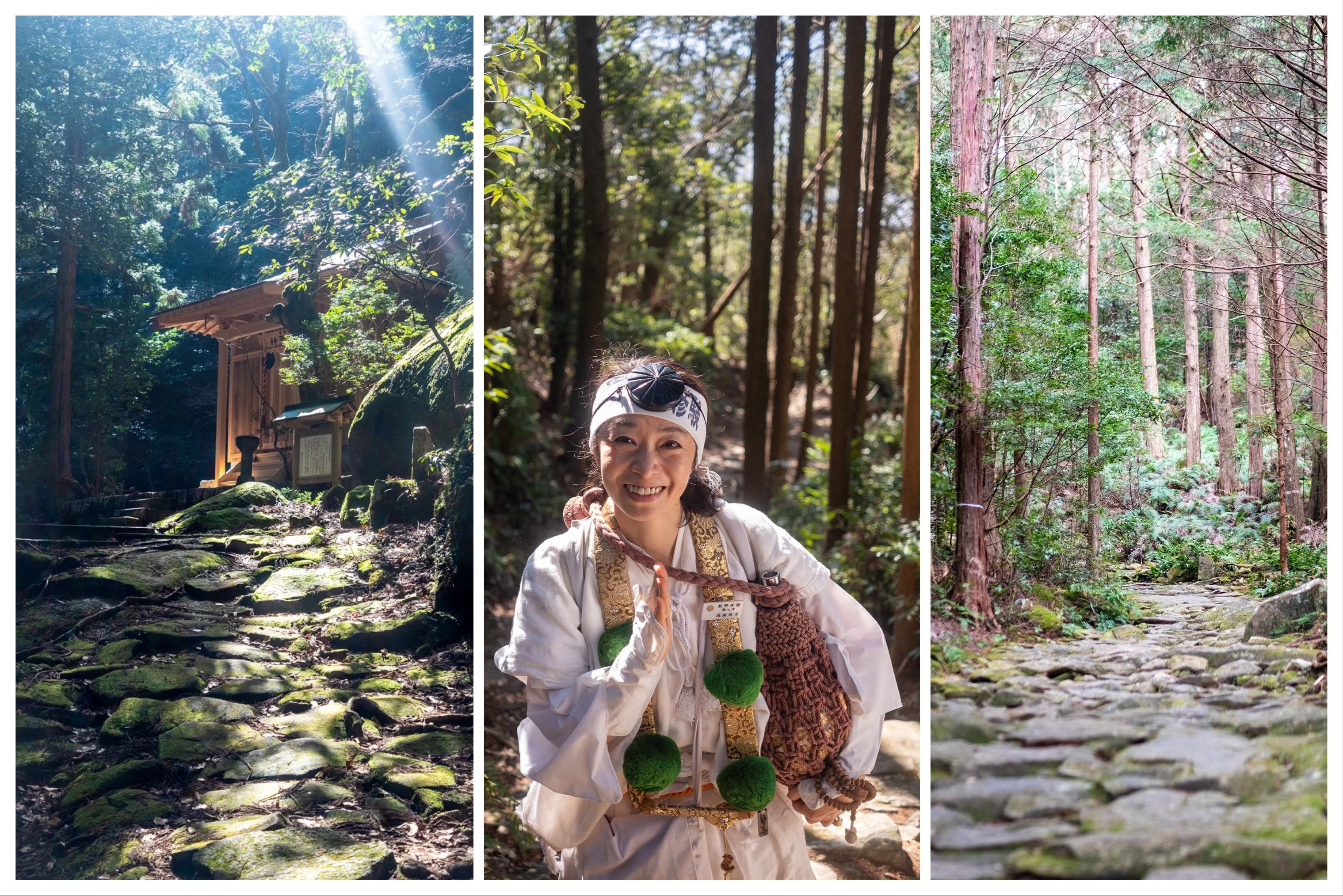
Kii Peninsula, located in southern Kansai, may not immediately ring a bell until I mention the Kumano Kodo, a network of pilgrimage routes connecting Kumano’s three sacred shrines - known as Kumano Sanzan - as well as Koyasan, the center of Shingon Buddhism.
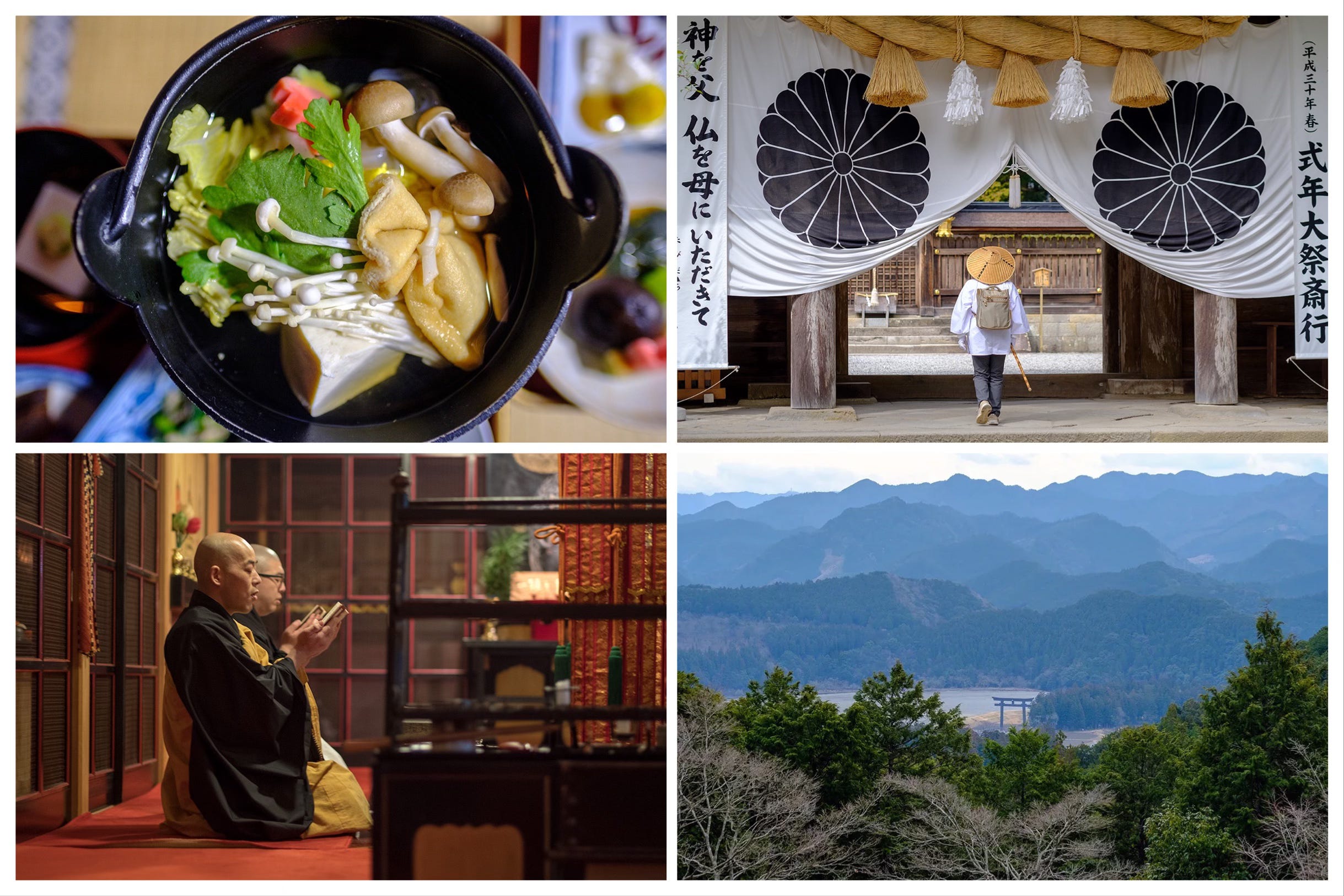
Nakahechi, the Imperial Route, connects Takijiri in the west to Nachi Falls in the east, the country’s tallest, standing right next to Kumano Nachi Taisha Shrine, one of the Kumano Sanzan. The route is typically walked in four to six days, making it the shortest and the most visited of the seven routes that form the Kumano Kodo pilgrimage network.
The roughly 70-kilometer route benefits from well-established visitor infrastructure, which makes logistics easier to organize (though harder to book due to high demand) than on alternative routes. I first walked it in 2018, before moving to Japan, and will walk it again next month with two friends, with a detailed account to follow in the travel diaries series.
Another Kumano route I have partially experienced is the 170-kilometer Iseji Route, which connects Ise Shrine with Kumano Hayatama Taisha, passing through coastal towns, picturesque mountain passes, rice fields, and beaches.
Between the two, I think Nakahechi offers a more digestible, compact pilgrimage experience, while Iseji feels a little more secluded and offers greater landscape diversity, with more local life woven into it.
For first-time visitors, Nakahechi is probably the better fit. Iseji, on the other hand, may be better enjoyed on subsequent visits, when a bit more familiarity with Japan may help you to appreciate the deeply rural, and sometimes ghostly scenery, in a more generous context.
Further north, but still in Kansai, sits a lovely little city that I will always have a soft spot for.
As with Okinawa, hiking is probably not the first thing that comes to mind when you think of Kyoto. But when you look up, you realise that the city and its thousands of temples are scattered along three mountain ranges: Kitayama, Higashiyama, and Nishiyama.
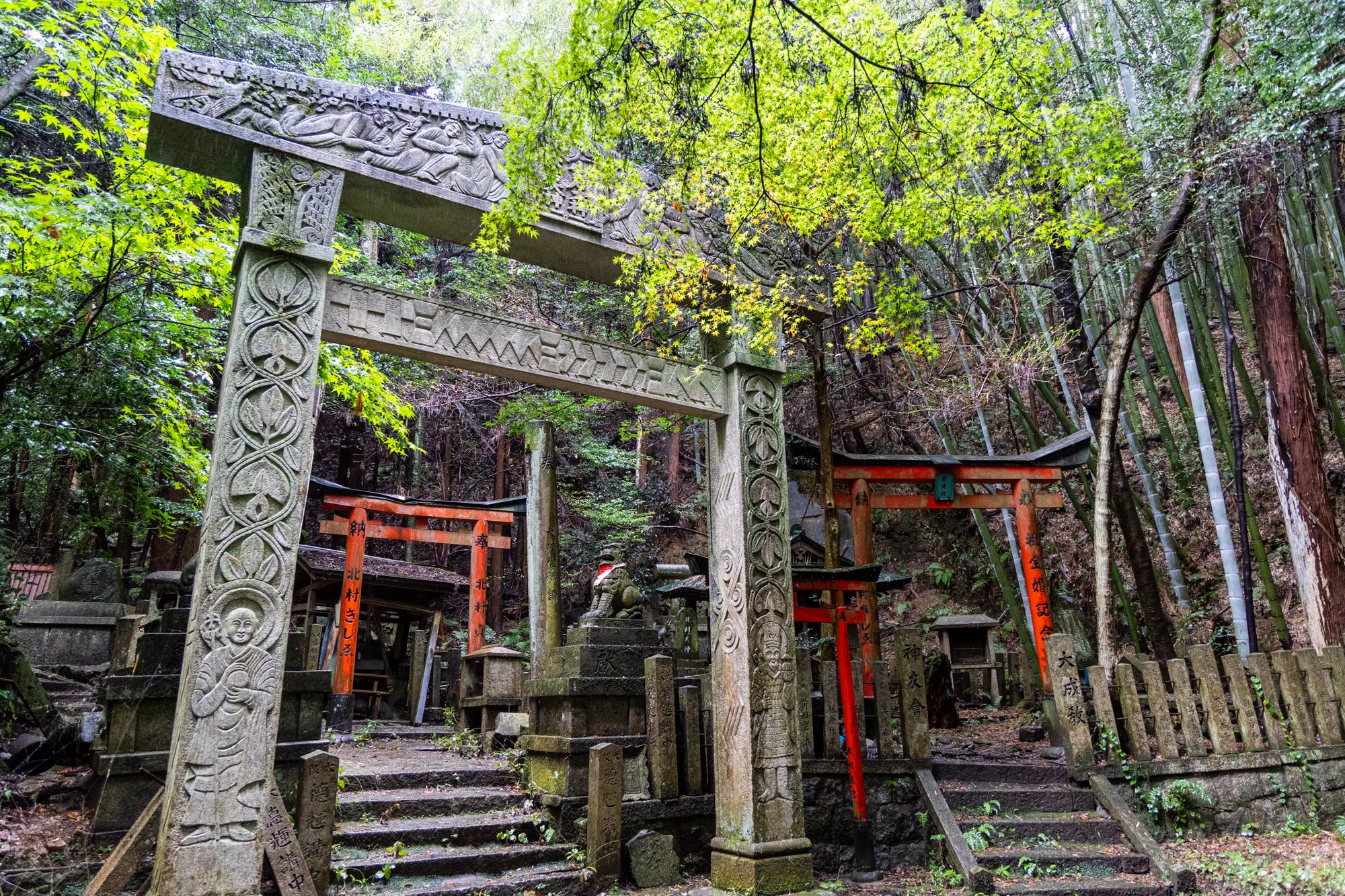
The Kyoto Trail, an 80-kilometer route that circles the city through these mountains, sneaks right behind some of its most visited sites, such as Kiyomizu-dera, and offers a much more secluded, behind-the-scenes look at its wonders.
The trail that I covered last year in the travel diaries series can be walked in four to five days. Thanks to its many trailheads within the city or easily accessible from it, weaving shorter sections into even a brief Kyoto itinerary is also very doable.
The northern neighbour of Kansai is the Chubu region, known as the “spine of Japan” and home to many of the country’s heavyweights in high-altitude hiking.
This is where you’ll find some of Japan’s most technical alpine routes, including Daikiretto and the Gendarme, with exposed ridges and steep drops on both sides (judging by the photos - as you might have guessed - not from personal experience).
The region, fortunately, also has more than a few non-hair-raising trails that still give you a taste of Alpine scenery, albeit without the extreme thrill.
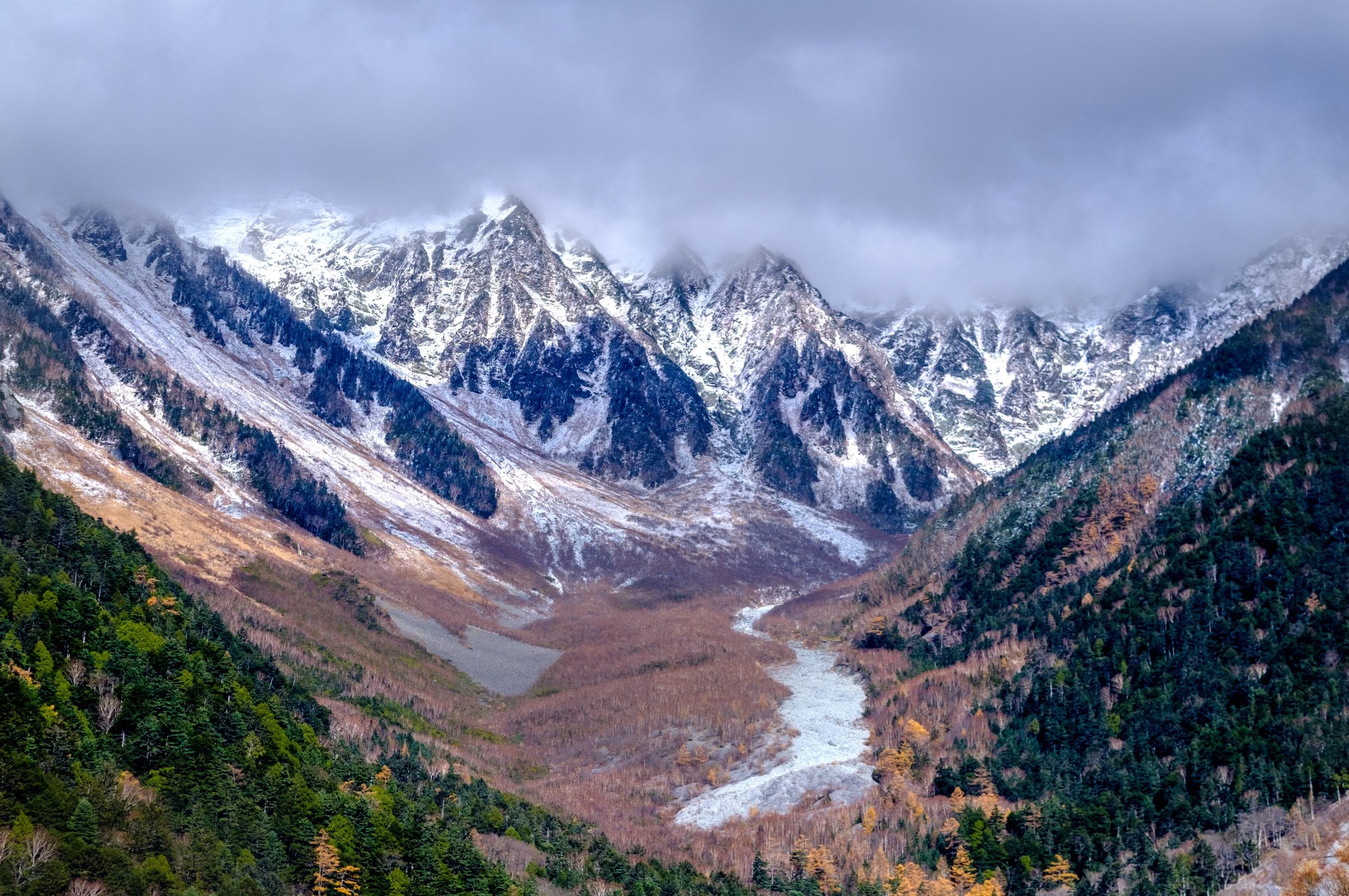
In Nagano, Karasawa Cirque, one of the most popular autumn color hikes in the country, is accessible from the Kamikochi Valley and can be done as a day hike if started very (very) early. The more enjoyable option, though, is to turn it into a two-day affair with a stay up in the mountain in one of the always fully booked huts, or at the wonderful Tokusawa Lodge down in the valley.
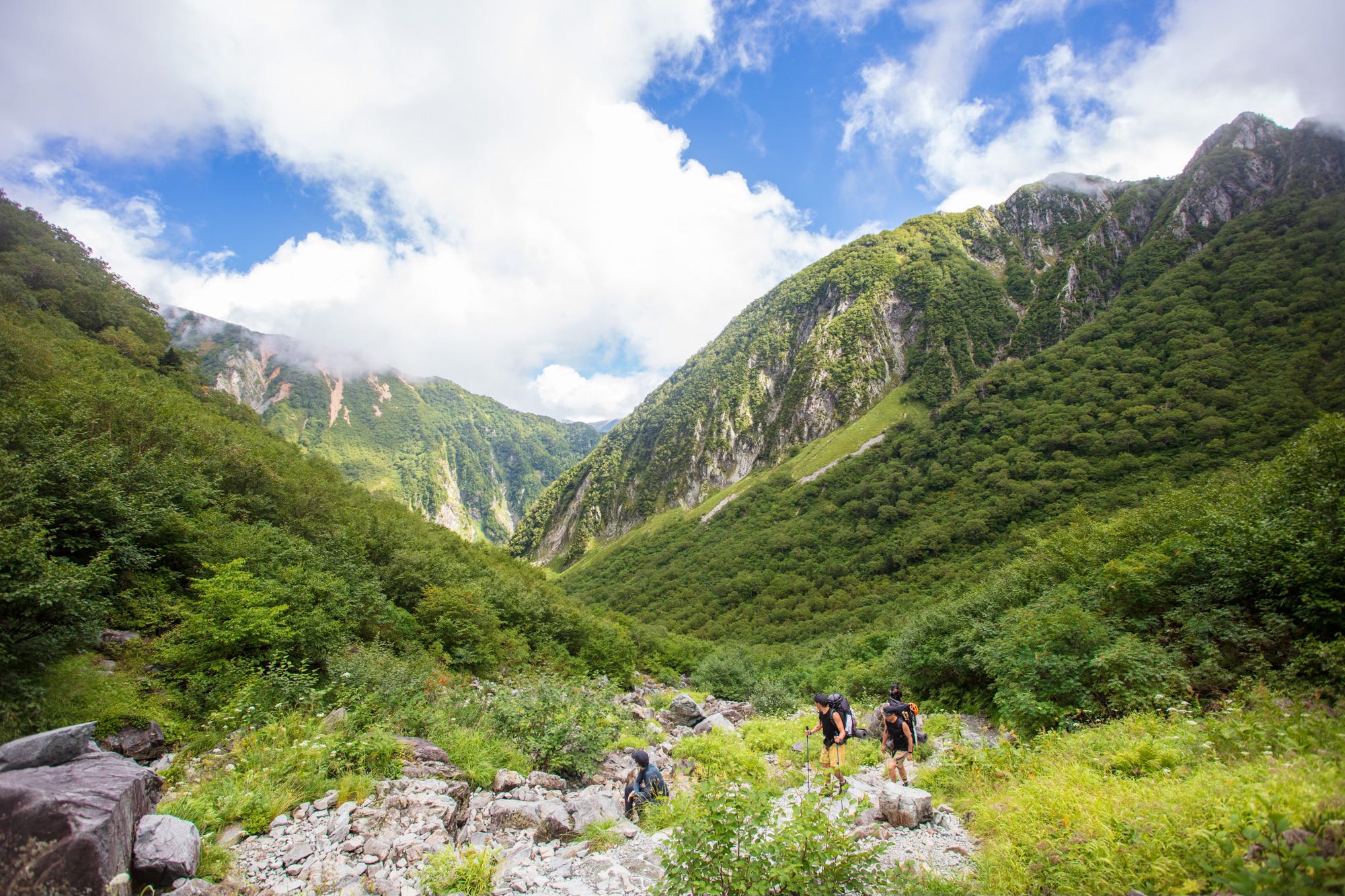
Another good introduction hike to the Japanese Alps is Yake Dake, located on the border of Nagano and Gifu prefectures, with a picturesque crater pond accessible from either the Kamikochi side or the Nakanoyou trailhead. I did the Nakanoyou option, which takes around six hours. The Kamikochi side involves some chain sections, but I’ve read that they are fairly manageable.
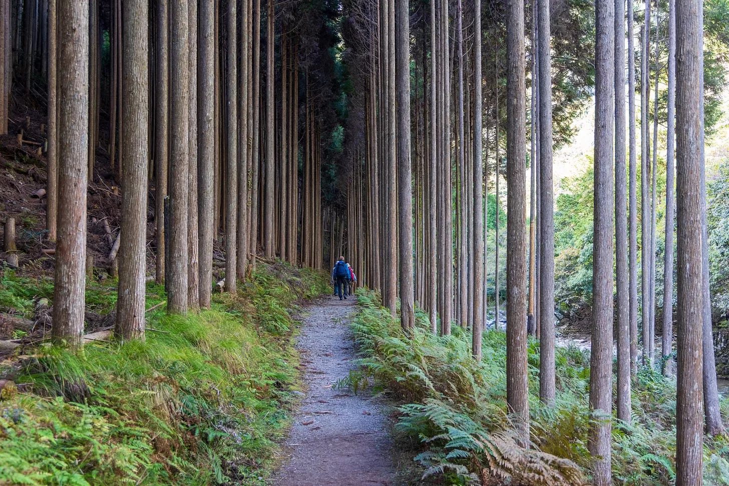
Nagano and Gifu are also both blessed with a large portion of the Nakasendo Trail - the historical Edo period route that connected 52 postal towns of Japan. The short 2-3-hour hike between Magome and Tsumago is a very popular option for getting a taste of the route, even on a day trip.
The western neighbour of Nagano Prefecture, Toyama, is known not only for its seafood and for having made the New York Times’ 52 Places to Go list in 2025, but also for the Tateyama Mountain Range.
Known for its patchwork-like facade, the mountain range owes its instantly striking beauty to distinct geological and ecological features that sit unusually close to one another and put on a spectacularly colorful show, particularly in autumn.
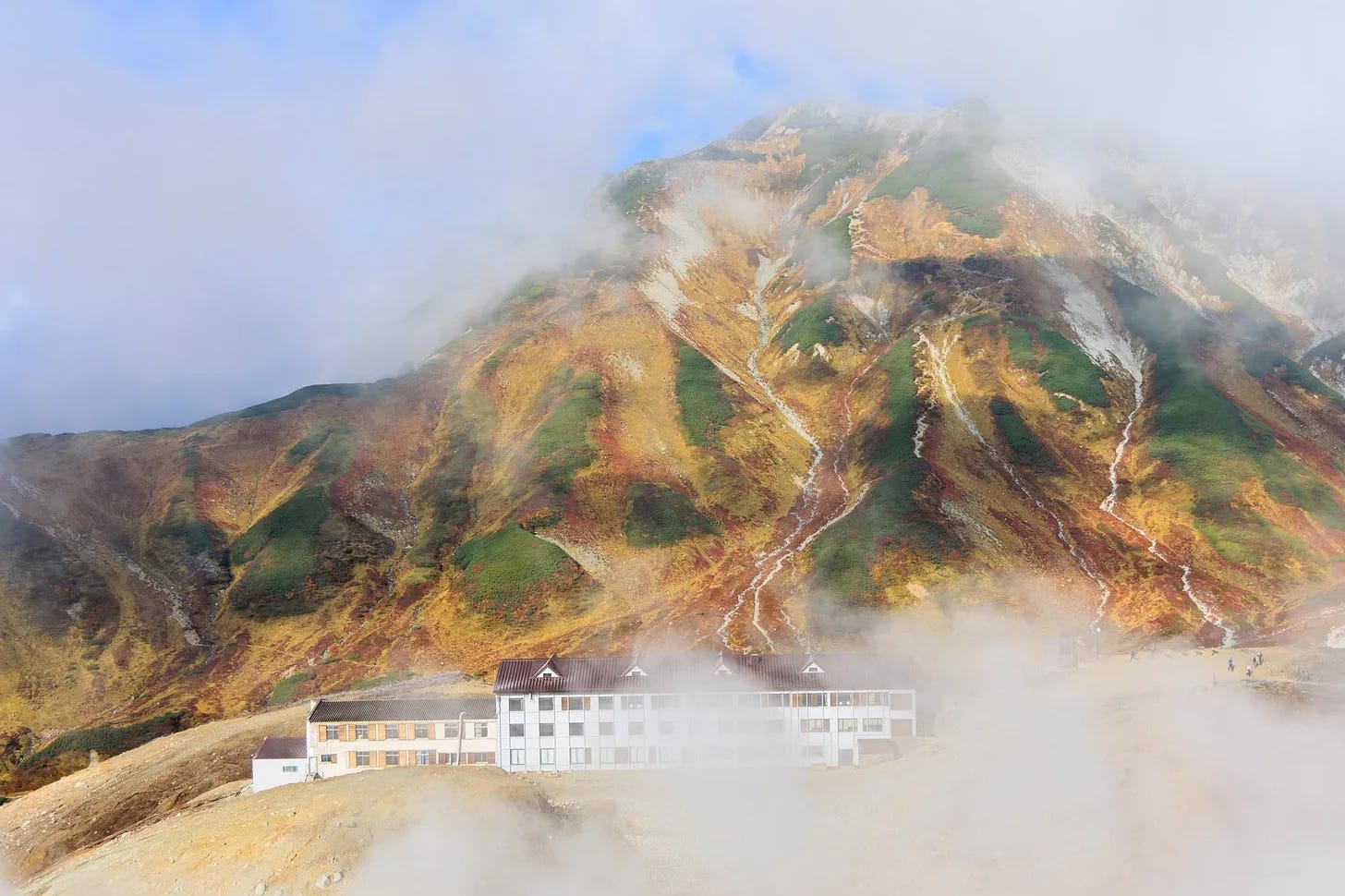
Similar to Kamikochi Valley, the base of the Tateyama Mountain Range, accessible from Tokyo via a combination of Shinkansen, local train, cable car, and bus, is a gateway to a wide variety of hikes, ranging from easy strolls around ponds to some of the most challenging in the country, including Mount Tsurugi. There are numerous huts in the area that are great options for longer hikes that require an early start.
At the far northwestern end of the Chubu region lies Niigata Prefecture, which hosts several famous trails in Myoko-Togakushi Renzan National Park.
The hike I want to introduce here, however, requires us to step off the mainland and take the ferry to Sadogashima, which was featured on AFAR Magazine’s 2026 list of places to visit, making me appreciate this inspiring travel magazine even more.
I visited Sadogashima a few years ago, almost by accident, when I had to cancel my Daisetsuzan trip at the last minute because of heavy rain, and the island seemed to be the only sunny place in the country at the time.
During a short three-day stay, which I would happily have extended had I found a room, I hiked the Sadogashima Island Traverse, which connects Donden Highlands to the Hakkundai viewpoint.
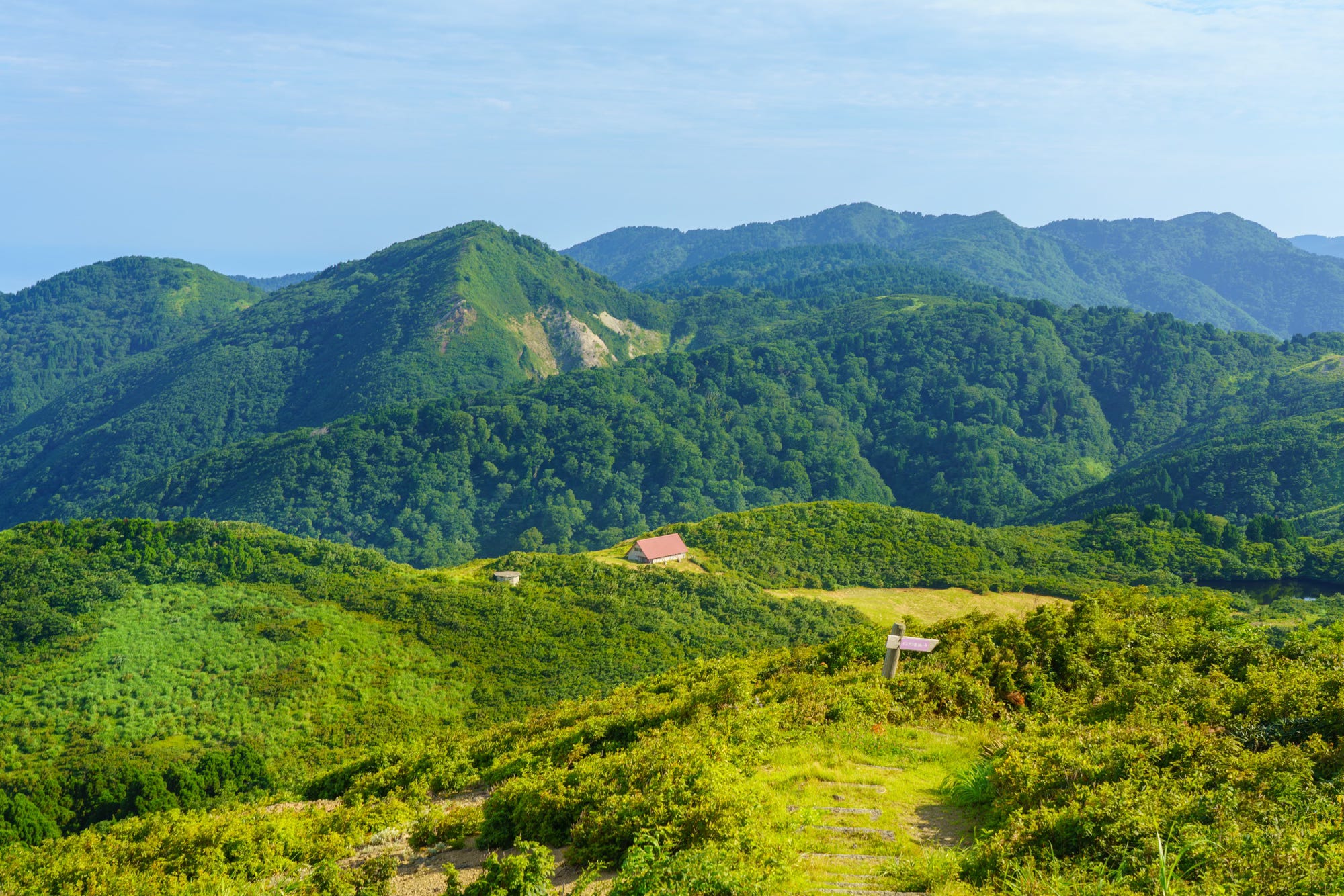
Taking around five to six hours, the trail encompasses a surprisingly diverse range of landscapes and even a few unexpected man-made scenes. You begin in dense, mossy forests, move on to tolerably exposed rocky ridges with views of the Sea of Japan, and, in summer, walk through fields of alpine flowers, before reaching an ending that feels like stepping into an alternative reality.
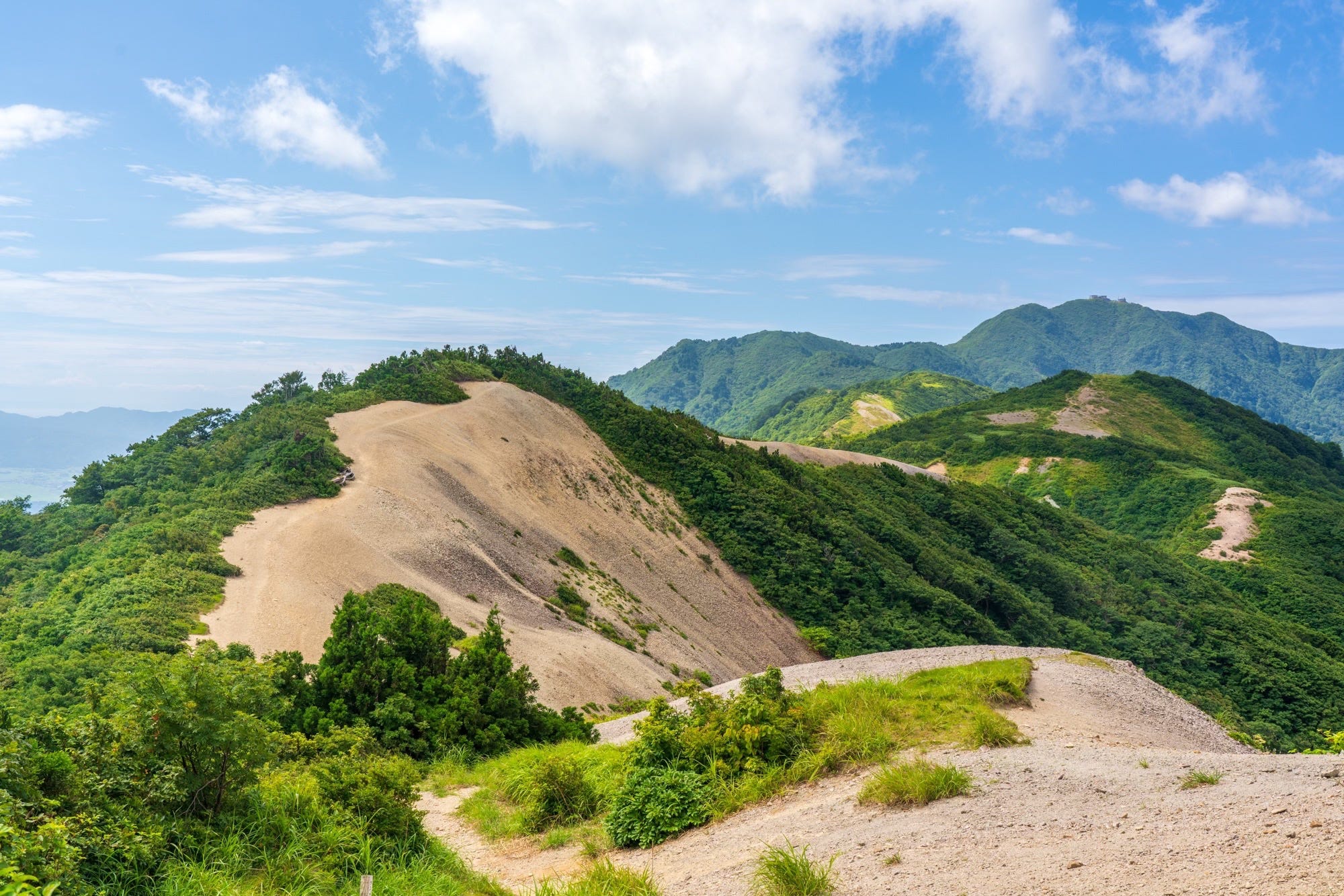
The final section of the Sadogashima Island Traverse follows a paved road operated by the Japan Self-Defense Forces to monitor maritime traffic and air defence radar operations. Lined with strange structures, this last stretch of the hike made me feel as though I had wandered into an apocalyptic science-fiction film, albeit one likely shot in the 1980s, which, in retrospect, felt very on brand for Japan.
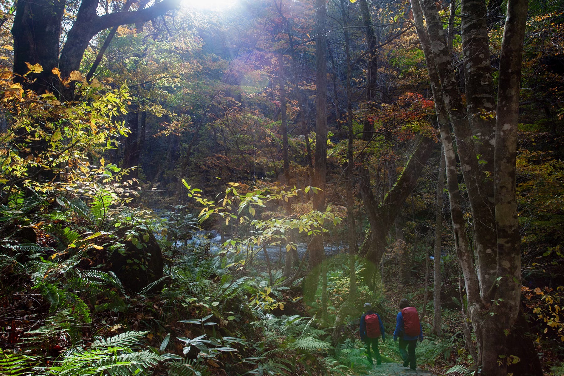
Crossing back over the mainland and quickly leaving Chubu behind, let’s make a short but personally meaningful stop in Tochigi Prefecture, home to Nikko National Park.
The area I visit every October, sometimes twice, is the one place I would choose if I had only one option for enjoying autumn foliage in Japan, for the variety of scenery it offers.
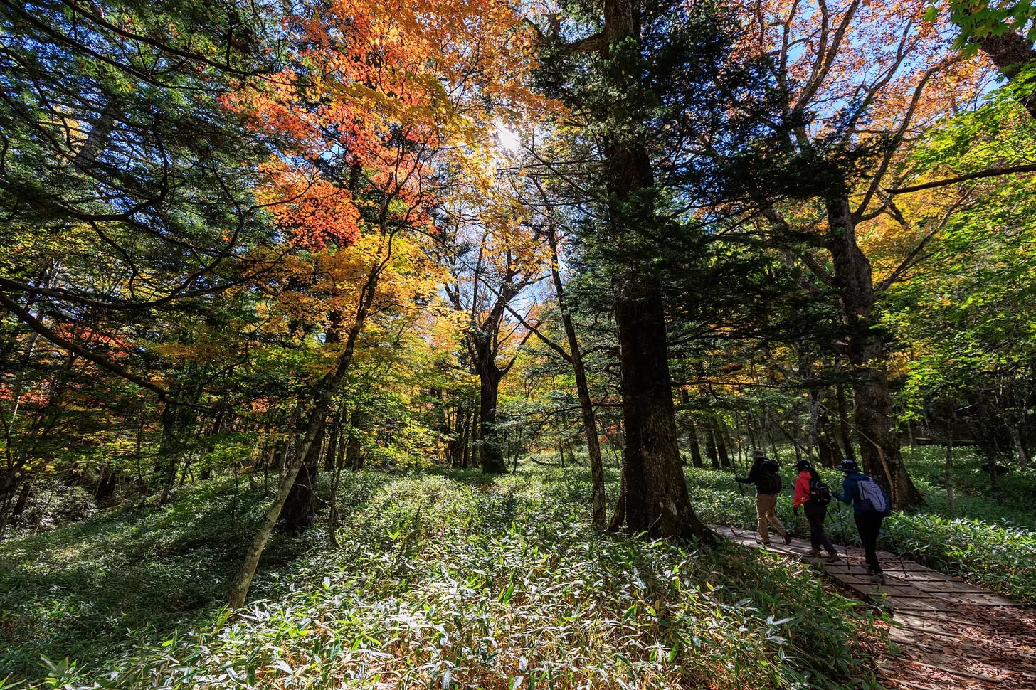
In the span of just three hours, you can walk past three waterfalls and two marshlands, each with a distinct character, one vast and seemingly endless, the other more private and secluded, surrounded by thick trees. Along the way, there are various small ponds, all tucked between two of Japan’s most picturesque lakes, Chuzenji and Yunoko.
But beyond all of this, what really draws me to Nikko is its forests, which may not be as striking at first sight, yet pull you in slowly, offering colourful surprises at every turn. The area is so vast that you can, if you wish, spend hours within that beauty without a single sign of civilisation, feeling a little like Alice in Wonderland every autumn.
As we near the end, we move on to Tohoku, but we will spend an unexpectedly short time there.
Despite being one of the regions in Japan I love the most, and one that is frequently featured in this newsletter, it is also the one whose hiking trails I am least familiar with.
While Tohoku is home to wonderful routes, including the 1,000-kilometer-long Michinoku Coastal Trail, created as part of the region’s post-disaster revitalisation efforts, my own walks there usually consist of easy strolls between onsen towns or well-visited short routes such as Oirase Gorge or Yamadera.
Part of the reason is that, while Hokkaido has a denser bear population, many of its trails, especially around Daisetsuzan National Park, tend to attract more visitors, creating at least a small, if sometimes misleading, sense of safety for an often solo hiker like me. In Tohoku, however, you are far more likely to find yourself entirely alone on the trail, and that is something I find very difficult to manage psychologically, in a bear territory.
So, let’s move on to Hokkaido, with its bears, but also its more populated hiking trails.
If, for some strange reason, there were a rule that I could only pick one main island of Japan for this hiking letter, I would probably have to choose Hokkaido.
Japan’s second-largest island hosts an extraordinary diversity of landscapes and outdoor experiences. This is where you will find some of the country’s most gorgeous trails, reminiscent of Switzerland, alongside routes that feel unmistakably domestic, shaped by active volcanoes, poisonous calderas, and dramatic cliffs.
One could easily spend weeks in Daisetsuzan National Park, Japan’s oldest and largest national park, doing day hikes or exploring more deeply through a multi-day traverse.
One of my favourite routes in the park connects Asahidake Onsen to Sounkyo, passing either over Mount Asahidake, Hokkaido`s highest peak, or through the Susoidaira Valley, which bursts with colour in July and early August when alpine flowers blanket the valley.
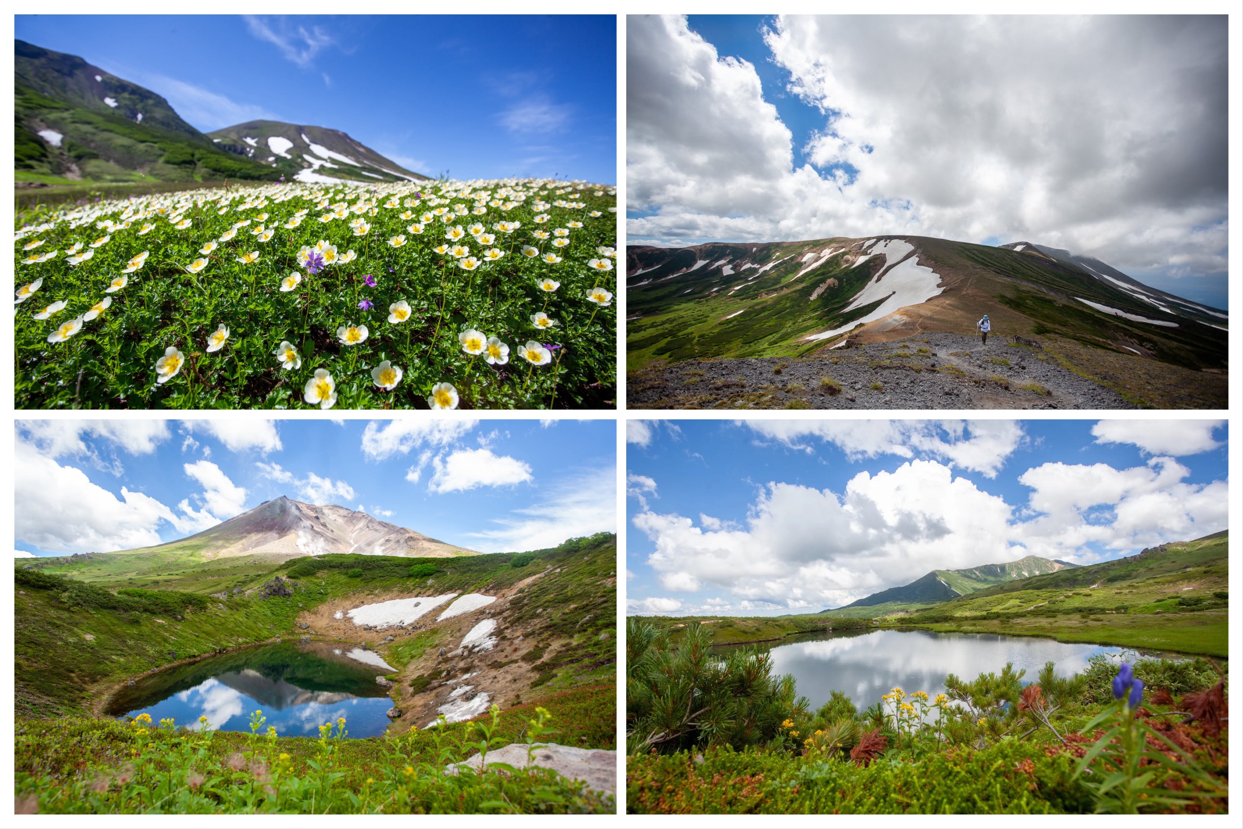
One particularly enjoyable way to do the hike is to spend the night at Asahidake Onsen, as I did, and have your luggage forwarded to Sounkyo. You can then walk through the mountains the following day and end at one of the ryokans in Sounkyo Onsen, where your luggage will, hopefully, be waiting for you.
Yet Hokkaido’s appeal is not limited to its vast inland mountain ranges. The island’s northern and coastal landscapes offer a very different kind of beauty, softened by the turquoise waters that surround them.
Rebun Island, with its summer wildflowers and, mercifully, no bears, is another deeply rewarding destination. Like Daisetsuzan and Nikko National Park, it is one of those places that sometimes makes me think I might have been a little unfair to this country and its beauty in my previous letter, a little provocatively titled - The Very Questionable Beauty of Japan.
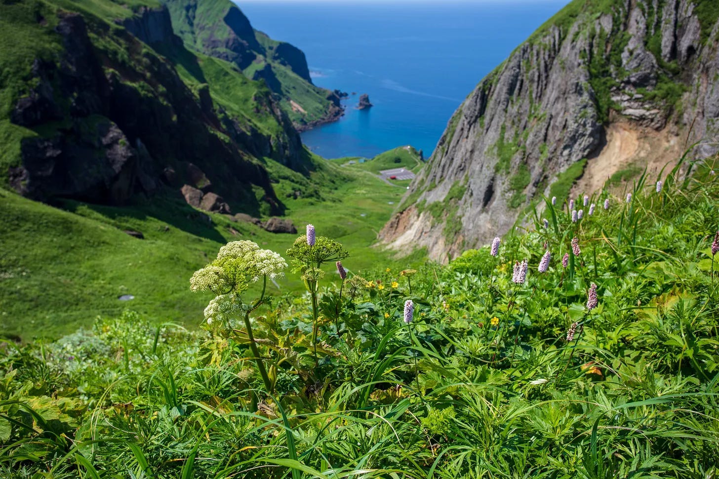
Among the island’s many trails, the Momoiwa Trail, which follows the rugged coastline along a high ridge, is the most visually memorable one. A close second is the Cape Course, which connects the island’s three picturesque capes: Sukuton, Gorota, and Sukai.
In the DIY walks department, my favourite in Hokkaido was recently featured in the January edition, along with more extensive diary-style coverage last year. Unlike the other hikes listed here, this is a winter walk that follows narrow country roads around Biei in central Hokkaido, introducing you to one of the most strikingly minimalist snowscapes our planet has to offer. You could easily spend a week in the area, setting off in a different direction each day and adding a few side trips along the way.
So this wraps up this hiking-heavy edition of the newsletter, which began at 24°N in the subtropical south, in Iriomote, and ended at 45°N in the near-subarctic north, in Rebun.
Shortly after I push the send button, I will head to Haneda Airport, not for a hiking trip this time, but to welcome two of my closest friends for their week-long first visit to Japan.
As always, thank you for being here, for your time, your interest, and, more importantly, your kindness.
I will be back in March.
Until then,
Burcu
P.S. In addition to the monthly letters, below is a quick recap of the extra itinerary and planning-focused posts available on the newsletter for monthly and annual subscribers. You can access each one here on Substack or on a single page on my website.
Shibu Onsen and the Snow Monkeys of Nagano (February 2026)
One Fine Autumn Day in Tokyo (December 2025)
Tohoku Onsen Hopping: Four Nights, Four Hot Springs (November 2025)
Tokyo Eateries: the Non-Gourmet Version (October 2025)
Autumn Colors Trip to Aomori: Itinerary Suggestion (August 2025)
One Fine Day in Kanazawa (July 2025)
Cycling the Shimanami Kaido in Two Days (June 2025)
Japan Trip Planning Q&A Series (three posts) (February - April 2025)
Winter Trip to Biei in Hokkaido (four posts) (January 2025)
Hiking the Kyoto Trail (five posts) (November 2024)
One Fine Autumn Day in Kyoto (September 2024)
Walking Goto Islands (eight posts) (March 2024)
In each section, I will include hyperlinks to more detailed posts on the blog or in the newsletter, along with references to third-party sources where relevant.
Great article and some beautiful pictures!
Wow I loved this! I can’t wait to read more about your journey! I was able to spent 1 month on Kyushu in between May and June last year and it was perhaps my favourite place out of my 3 month Japan trip! Yakushima got my heart, so loved seeing your photos from your hikes there too. You captured the special soul of the island so beautifully. Thank you for sharing Burcu.